
DeLand Neighbor Record Layers
A block lookup works best as a set of layers. The parcel map defines which lots touch. The assessment roll names owners. A voter extract covers only registered voters after protected fields are removed. Permits, plats, and public civic pages answer different questions, and none proves the full household living behind one door.
| Source | What It Shows About a Block | Access |
|---|---|---|
| VCPA parcel and GIS browse | Lot shape, adjacency, situs address, and parcel identifiers | Free interactive county tools |
| Property Appraiser roll | Assessed owners plus mailing and situs differences | Free weekly updated portal |
| Public voter extract | Registered voter presence after exemptions | Records request or order form |
| Permits and code files | Visible work or case history and responsible parties | City portal or request if incorporated |
| Recorded plats | Subdivision lots, blocks, and shared areas | Volusia Clerk Official Records |
| Civic or association pages | Public board contacts and stated boundaries | Organization or city page |
The assessed owner may live at the situs, rent it, or hold it through a trust or company. A matching mailing and situs address or homestead exemption is consistent with owner occupancy, but it still does not identify every resident. Keep nearby owners distinct from DeLand neighbors who occupy the homes.
DeLand Blocks Cross Boundaries
Postal DeLand extends past the incorporated city. North DeLand, West DeLand, DeLand Southwest, and other unincorporated places can use a DeLand mailing city while county agencies handle permits and code matters. The Spring Hill community redevelopment area even straddles incorporated and unincorporated land.
Check the parcel municipality and GIS city-boundary layer before opening the DeLand Citizen Portal. An incorporated lot can have city permit or code history. A nearby unincorporated lot may require Volusia County channels instead. ZIP and mailing city alone cannot settle jurisdiction.
Note: Two DeLand neighbors on one road can use different permit and code custodians when a city boundary cuts through the area.
Map DeLand Neighbors by Parcel
Use the Volusia parcel and GIS map as a spatial index. Search the target address or Parcel ID, zoom until each outline is clear, and click the lots sharing a boundary or directly across the street. Then open the official detail for every selected shape.
- Locate one verified address and confirm its situs, Parcel ID, municipality, and map position.
- Click adjoining lots and those directly opposite, recording each parcel identifier before any name.
- Open each parcel card to confirm assessed owner, mailing address, exemption, and legal description.
- Mark condominiums, common parcels, vacant land, and association-owned areas instead of forcing a house-per-lot pattern.
- Pan only far enough to define the immediate block; use the street workflow when the question expands.
Parcel boundaries and measurements are assessment aids, not a title survey. Confirm ownership on the Property Appraiser Public Access and title in Clerk instruments. For a full road, the DeLand street directory carries the address-by-address chain.
Read DeLand Lots and Plats
A condominium can place many units inside one building footprint. A subdivision can include association-owned entrances, ponds, lanes, or recreation parcels. These shapes break the easy assumption that one polygon equals one household. Record unit Parcel IDs and common parcels separately.
Recorded plats in Volusia Official Records explain lot and block numbers, easements, and shared areas. A plat organizes land; it does not name today's residents. Carry its subdivision and lot terms back to each parcel card to keep the block aligned.
DeLand Voters on a Block
The individual Volusia voter lookup asks for a first name, last name, date of birth, agreement checkbox, and CAPTCHA. It is meant for a voter to check that voter's own status, not to browse a street. A House Number prompt may appear when the first inputs match more than one record.
A lawful public voter extract is a different channel. Requesters can use the Supervisor of Elections public-records page, Elections@Volusia.org, 386-736-5930, or mail to 1588 N. Woodland Boulevard, DeLand. Ask for the data dictionary, extract date, geography, format, and current cost. Protected addresses and confidential fields must be suppressed.
The exact Volusia voter status form shows why the individual service cannot function as a general neighbor list.
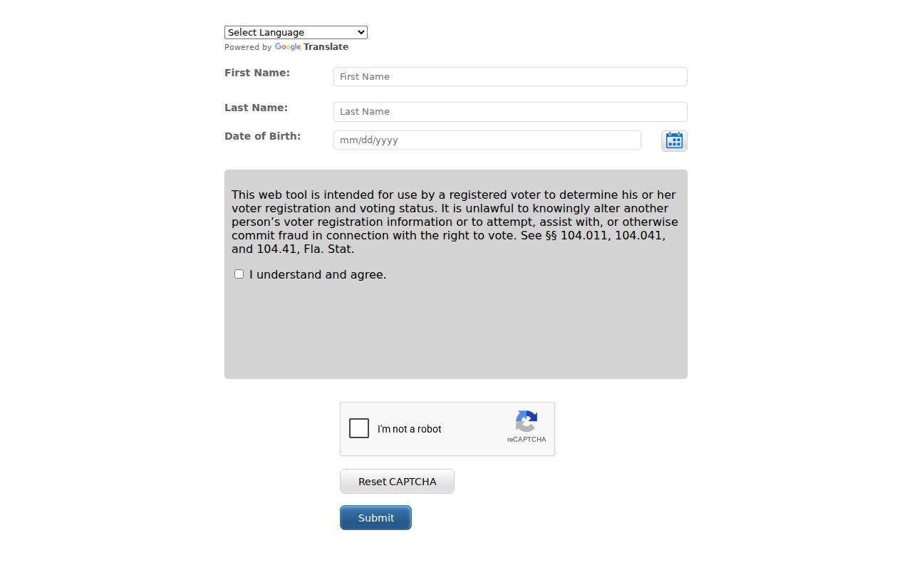
Even a proper extract includes registered voters only. It omits nonvoters and minors, can lag a move, and never reveals ballot choices. The source can add a dated voter-presence layer, but it cannot name every person on a block.
DeLand Community Contacts
Neighborhood associations, historic groups, congregations, and clubs may publish a board roster or contact. Those entries identify a person authorized to answer a community question. Private member directories remain private and are not public resident rolls.
Volusia County Public Library
Branch and research services connect addresses with newspapers, genealogy sources, and local history.
Stetson Archives
University archive contacts can lead to yearbooks, photographs, alumni publications, and institutional neighborhood history.
Historical Society
West Volusia Historical Society and area museums may hold house photographs, family files, church material, and vertical files.
Use only public contacts each group chooses to post. A board name documents a public role, not the makeup of nearby households. Historical collections can explain an old block without exposing a private roster.
Compare DeLand Neighbor Sources
Official records and commercial neighbor tools can show similar names because compiled products repackage parcel, voter, and other data. The difference is provenance. An official parcel card has a known custodian, update cycle, and purpose, while a compiled profile may join unrelated people or retain an old address.
| Source Type | Best Use | Main Limit |
|---|---|---|
| Official parcel and deed records | Confirm assessed ownership and recorded transfers | Do not list all occupants |
| Official voter records | Confirm lawful registered-voter facts | Protected fields and nonvoters are absent |
| Commercial compiled tools | Possible lead for later official checks | Stale addresses and false same-name joins |
Use the custodian record for any claim that matters. If a commercial listing is wrong, its removal process does not change the underlying deed, voter file, or parcel roll. Corrections must go to the source that holds the error.
DeLand Neighbor Safety Records
Public safety records answer narrow questions and should never be folded into a general list of DeLand neighbors. For an incident tied to a known place and date, the Volusia Sheriff's reports channel is the custodian route for Sheriff incident and Florida traffic-crash reports.
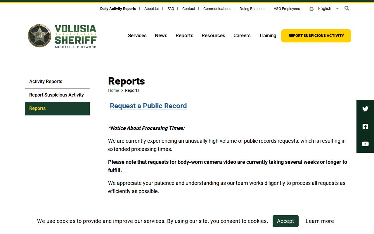
Requests work best with the agency, report or case number, date, time, location, and involved name. Redactions may cover active investigations, juvenile facts, victim data, medical details, and other exempt material.
The official Florida Department of Corrections Offender Search covers the state corrections population, not every current DeLand resident or county booking.
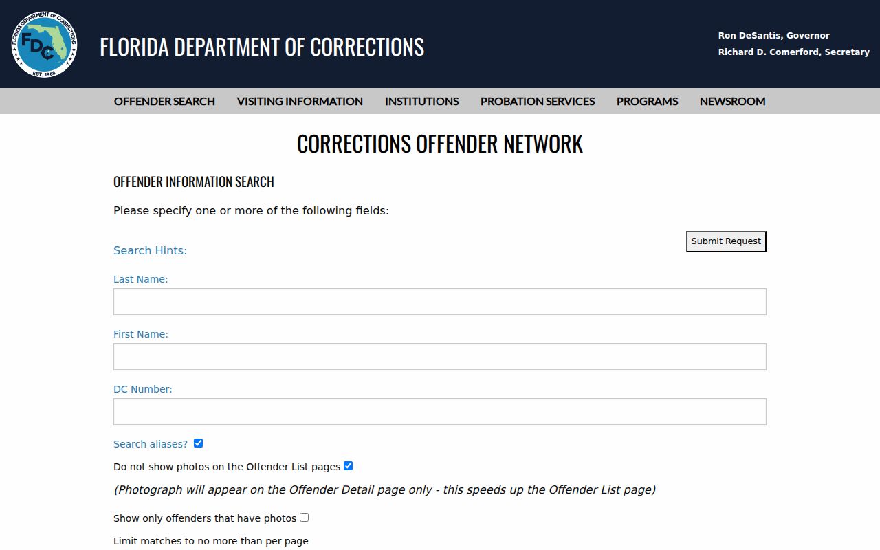
A result can show custody or supervision facts, aliases, a facility, and sentence data. Verify identity and status at the source because a same-name result does not establish that the person lives on the block.
The FDLE offender and predator registry offers a geographic search with an address, city, ZIP, and radius.
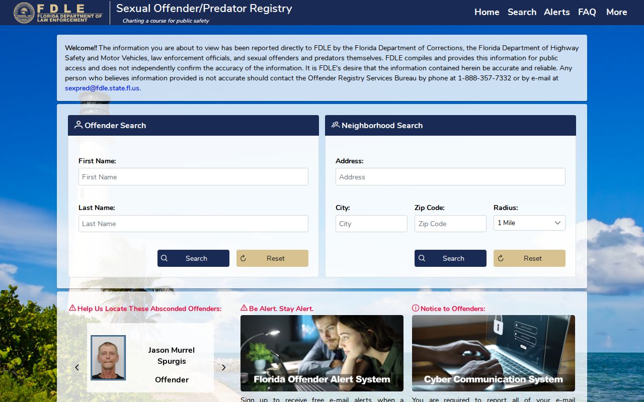
Registry data comes from reported information, and FDLE says fingerprints are required for positive identity. Follow the site's legal warning. The registry is a purpose-specific safety source, not a substitute for parcel records or a full neighborhood directory.
Protect DeLand Neighbors' Privacy
Florida's open-record system has targeted exemptions. Protected home addresses, voter application identifiers and signatures, driver data, sensitive vital records, and sealed court material are not gaps to work around. The Attorney General's Address Confidentiality Program gives eligible people a substitute mailing address and forwarding through participating agencies.
Utility customer data is not a neighbor directory. Delivery records and private association rosters also sit outside these public block layers. Do not try to reconstruct a protected address. A missing person may be protected, may rent, may not vote, or may simply not appear in the chosen record.
Lawful use. Check DeLand neighbors for civic curiosity, reconnecting, or personal safety awareness. Never use public records to watch, expose, threaten, or harass anyone.
Verify Each DeLand Neighbor
A clean block worksheet keeps one row per parcel and separate fields for situs address, assessed owner, mailing address, municipality, and source date. Add a voter or permit fact only when its record clearly matches. This prevents an owner in another city from being labeled as an occupant.
Current rolls change. The Property Appraiser database updates weekly, voter status follows election records and list maintenance, and permits can change while work proceeds. Save the source date and return to the official record before relying on a result. A strong neighbor lookup states what each record proves and leaves private household facts unstated.